Trip Report: 2014 Bicycle Tour
Burton, TX to Key West, FL along the Adventure Cycling Association Southern Tier Route.
This page is a report of my solo bicycle tour in 2014. I followed the Adventure Cycling Association (ACA) Southern Tier Route from Burton, TX to St. Augustine, FL. Then I took the ACA Florida Connector Route from St. Augustine, near Orlando, then Ft. Meyers, and then Ft. Lauderdale. Then I followed the ACA Atlantic Coast Route from Ft. Lauderdale to Key West, FL.
See the sidebar for information about the Adventure Cycling Association, the route, and my bike and gear. I camped and stayed in motels depending on the location, weather, etc.
Click any of these links to see:
- Photos from the trip.
- Photos of roadkill along the way requested by my friend Anette.
- List of the roadkill species photographed on this trip. (PDF file)
- List of all the species in the roadkill photo album.
- List of the birds that I saw on the trip (PDF file)
Travel Log
Showing days: 16-30 Show other pages: 1-15 31-45 46-60 61-70
Click the or by the title of any day to expand or collapse the details for that day.
| Day 16, Tuesday, February 11, 2014. | |
|---|---|
| Simmesport, LA. |
Miles, Time (day/trip): 0/409.5, 0/1:21:43.
The parts for my pannier arrived. I repaired my pannier as well as some other items like my leaky Therm-a-Rest mattress. I am ready to hit the road in the morning.
There was miserable weather today and tonight. It's 32°F, pouring rain, with a 15 MPH north wind right now. Freezing rain is possible tonight, but all this is forecast to end in the morning.
| Day 17, Wednesday, February 12, 2014. | |
|---|---|
| Simmesport, LA to New Roads, LA. |
Miles, Time (day/trip): 43.9/453.4, 4:31/2:02:14.
Not a very propitious start to the day. There was an ice and freezing rainstorm that began early yesterday evening. Sometime around midnight, the power went out and stayed out in Simmesport, presumably from the ice. Fortunately, I am prepared for camping outside so I got out my sleeping bag and slept warm and comfortably.
This morning, the tree branches as well as cars in the motel parking lot were covered in ice. It was drizzling heavily and 32°F. The road was wet, but it didn't look frozen. Immediately after leaving Simmesport, I had to cross a giant, high, ½ mile long, bridge over the Atchafalaya River. The local police had no information about icing on the bridge except, "There might be ice on the bridge."
I couldn't get any information about when the power might be restored. I couldn't decide which was the lesser evil, to stay in the motel with no light and no heat or to brave the road. I couldn't even read at the motel. My kindle is broken, I don't have a paper book and there is no place in Simmesport to buy one. I can read Kindle books on my phone, but with no electricity to charge the phone, I can only do that for about an hour or two.
I made the decision to ride at about 9:30 AM. There was ice on the concrete barriers on the sides of the bridge but none on the road surface. After that hurdle, I had a great ride. The temperature hovered just above freezing all day, but the rain stopped after about an hour. I had a 10 to 15 MPH tailwind. Dressed properly, I was not cold.
Despite all my trepidation about how miserable I was going to be, I had a nice day riding beside and atop the levees of the massive flood control system built by the Corps of Engineers to control the Red, Atchafalaya, and Mississippi Rivers.
This is a very wet and swampy area. I saw two beavers squashed on the side of the road. The Atchafalaya River Basin is the largest wetland in the United States.
I've now completed section 5 of the Adventure Cycling Association Southern Tier Route. Tomorrow, I move on to the Section 6 map whose Eastern edge is in Florida.
| Day 18, Thursday, February 13, 2014. | |
|---|---|
| New Roads, LA to Jackson, LA. |
Miles, Time (day/trip): 28.5/481.9, 3:03/2:05:17.
For the first time during the 18 days of my trip, the sun came out. I enjoyed a beautiful day of riding.
Shortly after leaving New Roads, I rode across the mighty Mississippi River via the spectacular John James Audubon Bridge. I entered the Feliciana area of Louisiana which was formerly a part of Spanish West Florida.
I visited the Audubon State Historic Site and Oakley Plantation. Construction of the plantation house began in 1799. The home was held by the same family for almost 150 years until the 84-year-old spinster daughter sold it to the state in 1942.
John James Audubon spent about 3½ months there in 1821 after he was hired in New Orleans to tutor the daughter of the very wealthy Pirrie family. During this time, he painted 32 of the pictures for "The Birds of America" .
I sampled wine made from locally grown muscadine grapes at the Feliciana Cellars Winery and Vineyards. I am staying at a very nice historic hotel in Jackson, the Old Centenary Inn.
| Day 19, Friday, February 14, 2014. | |
|---|---|
| Jackson, LA to Easleyville, LA. |
Miles, Time (day/trip): 43.8/525.7, 4:50/2:10:07.
Happy Valentine's Day to all you lovers out there. I rode hard today. It was very hilly. I will be camping out tonight.
| Day 20, Saturday, February 15, 2014. | |
|---|---|
| Easleyville, LA to Franklinton, LA. |
Miles, Time (day/trip): 42.0/567.7.0, 4:48/2:14:55.
I experienced another day in paradise, Sportsman's Paradise, Louisiana. There was great weather for cycling: sunshine, slightly cool, and little wind. It was again quite hilly today making for a brisk workout.
| Day 21, Sunday, February 16, 2014. | |
|---|---|
| Franklinton, LA to Bogalusa, LA. |
Miles, Time (day/trip): 34.0/601.7, 3:24/2:18:19.
I am almost across Louisiana. I wore my Polar heart rate monitor. It says I burned about 2000 Kcal riding today.
| Day 22, Monday, February 17, 2014. | |
|---|---|
| Bogalusa, LA to Poplarville, MS. |
Miles, Time (day/trip): 28.6/630.3, 3:08/2:21:27.
I rode across the flooding Pearl River from Louisiana into Mississippi today. I am staying in a pleasant house called Jerine's Guest Cottage, B&B here in Poplarville, MS.
Poplarville is infamous for a lynching as described in Wikipedia, "On the night of April 24, 1959, Mack Charles Parker, an African-American accused of rape, was abducted from the Pearl River County jail in Poplarville by a mob and shot to death. His body was found in the Pearl River 10 days later. The FBI investigated and even obtained confessions from some of the eight suspects. However, the county prosecutor refused to present evidence to a state grand jury and a federal grand jury refused to indict. The case focused national attention on the persistence of lynching in the South and helped accelerate the American Civil Rights Movement." A much more detailed and graphic description of the events can be found here: Wikipedia article on Mack Charles Parker.
| Day 23, Tuesday, February 18, 2014. | |
|---|---|
| Poplarville, MS to Perkinston, MS. |
Miles, Time (day/trip): 34.1/664.4, 3:39/3:01:06.
I continued my short ride along the coastal stub of Southern Mississippi today. There was warm weather. I rode all day in shorts and a short-sleeved shirt.
It's very pleasant right now. I am sitting in a recliner on the back porch of the RV park's pavilion overlooking a creek. It's 73°F and mostly sunny. This place has everything I need including unrestrained dogs to chase and bark at me and what every cross country touring cyclist desires at the end of the day, a stationary exercise bike.
| Day 24, Wednesday, February 19, 2014. | |
|---|---|
| Perkinston, MS to Vancleave, MS. |
Miles, Time (day/trip): 45.7/710.1, 4:40/3:05:46.
There was perfect weather again today. I am staying at an RV park next to a peaceful river. Tomorrow I'll be in Alabama. The day after that I'll be on a beach on the shore of the Gulf of Mexico.
| Day 25, Thursday, February 20, 2014. | |
|---|---|
| Vancleave, MS to Grand Bay, AL. |
Miles, Time (day/trip): 45.8/755.9, 5:00/3:10:46.
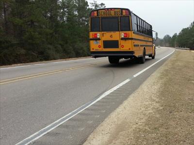
I started the day on this road in Vancleave, MS. This is the cyclist's nightmare: heavy traffic, a two lane road, only 24 inches of shoulder and most of that taken up by a rumble strip. Fortunately, I only had to ride this for about a mile.
There was nice weather at the start of the day. I rode into Alabama. I think this is the first time I've been back in Alabama since I moved from there 22 years ago. There was intermittent rain and strong headwinds at the end of the day.
| Day 26, Friday, February 21, 2014. | |
|---|---|
| Grand Bay, AL to Gulf Shores, AL. |
Miles, Time (day/trip): 53.5/809.4, 4:56/3:15:42.
There was a very intense thunderstorm in Grand Bay last night with very heavy rainfall and high winds. It was raining so hard that water pooled up on the ground faster than it could run off. My bivy sack leaked and my sleeping bag got a little damp. Inspection today showed the problem. My bivy sack is so old that the tape sealing the seams is coming loose. Fortunately, Connie is sending me my tent so that I'll be better protected from the rain and the bugs. The bugs haven't been a problem yet, but I expect that here near the coast and with the weather warming, mosquitoes are on the way.
I knew I was near the Gulf when I saw shrimp boats in Bayou La Batre, AL. While reading a historical marker in Bayou La Batre, I learned that "bayou" is the Gallicized form of "bok" which is the Choctaw word for creek.
I rode across a very long bridge to Dauphin Island this morning. At one point I thought I wasn't going to make it to Gulf Shores today. The Dauphin Island to Fort Morgan ferry didn't run all morning because of high winds. The alternative route would have required a long backtrack and a couple of days of riding.
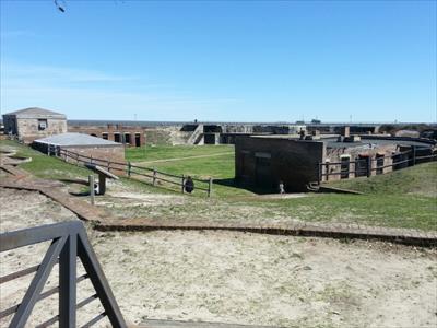
While waiting for conditions to improve, I toured the Fort Gaines Historic Site. The fort was constructed in the nineteenth century to guard the mouth of Mobile Bay.
Around noon, the ferry boat captain decided it was safe enough to proceed and I left on the ferry at about 12:30. The last 5 miles or so of my ride today was on a bike path into Gulf Shores, AL. Now I am off to find some raw oysters to eat.
| Day 27, Saturday, February 22, 2014. | |
|---|---|
| Gulf Shores, AL. |
Miles, Time (day/trip): 6.5/815.9, 0:54/3:16:36.
I took a rest day today. I did some gear maintenance this morning. I rode a short distance to the beach. I had boiled Royal Red shrimp and a margarita for lunch.
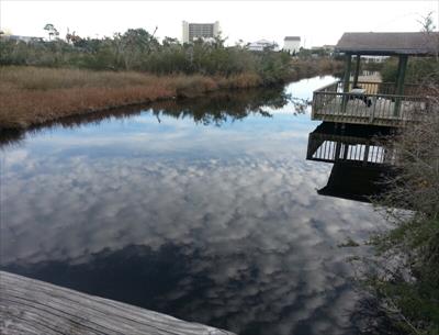
I went birding at the Wade Ward Nature Park in Gulf Shores, AL which is on the Alabama Coastal Birding Trail. I didn't see any alligators or many birds either.
| Day 28, Sunday, February 23, 2014. | |
|---|---|
| Gulf Shores, AL. |
Miles, Time (day/trip): 0/815.9, 0/3:16:36.
There was lightning, thunder, and heavy rain. It is expected to rain all day and night, but the weather should improve in the morning. I decided to make this a rest day.
| Day 29, Monday, February 24, 2014. | |
|---|---|
| Gulf Shores, AL to Milton, FL. |
Miles, Time (day/trip): 61.5/877.4, 6:35/3:23:11.
This morning I rode along the beautiful white sand beaches by Gulf Shores and Orange Beach, AL. I crossed the border into Florida.
I continued, skirting the Southern and then the Eastern Border of Pensacola, FL. I pedaled along the very hilly and aptly named Scenic Highway that runs atop the bluffs along the Eastern edge of Pensacola that rise above the bay.
There were beautiful homes along the Scenic Highway and one incredibly garish one. It had lots of gold paint on everything and a Rolls Royce parked in the driveway.
The bridge over the Escambia River just east of Pensacola had the widest shoulder I've ever seen. I had more room on the shoulder than the cars had in their lanes.
| Day 30, Tuesday, February 25, 2014. | |
|---|---|
| Milton, FL to Crestview, FL. |
Miles, Time (day/trip): 41.8/919.2, 4:23/4:03:34.
Today I rode northeast away from the coast. I started the day on a long bike path, the Blackwater Trail. Later, I rode through the Blackwater Swamp. I saw two dead river otters on opposite sides of the road directly across from each other. I chose not to put the picture of the dead otter on this page. To see it, click here. To see the complete collection of my roadkill photos click here.
For the first time on the trip, I had trouble following the Adventure Cycling Association map and directions. I made a wrong turn causing me to loop backwards requiring an extra 6 miles of riding. I compounded the mistake by standing in a fire ant mound while using my phone's GPS to double check my navigation after I made the wrong turn. I have not had the experience of having my foot and leg covered with fire ants since I lived in San Antonio almost 25 years ago.


